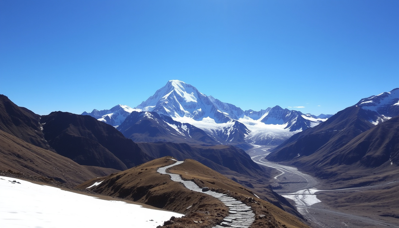
Anyone who’s stood at the Hooker Valley swing bridge on a clear morning already knows why Mount Cook draws people back — at 3,724 m it’s no Everest, and that’s part of the appeal: New Zealand’s highest peak anchors alpine scenery, glacier lakes, and walks for nearly every fitness level. The practical question isn’t whether you should go, but which track, which season, and how much time you can spare.
Height: 3,724 m (12,217 ft) ·
Māori name: Aoraki ·
Location: South Island, New Zealand ·
National park: Aoraki / Mount Cook National Park
Quick snapshot
- Aoraki / Mount Cook is New Zealand’s highest mountain, and the park around it holds 19 peaks above 3,000 m; short tracks like Kea Point reach viewpoints over Mueller Glacier Lake (New Zealand Department of Conservation (park authority)).
- The Hooker Valley Track is a 10 km return walk taking about 3 hours, crossing three swing bridges before reaching Hooker Lake (New Zealand Department of Conservation (track manager)).
- Current ice and snow conditions on the upper tracks — they change week to week, and DOC’s website carries the latest warnings.
- Exact annual rescue and incident numbers, which aren’t compiled in a single public database.
- How much day-tour prices will be on your dates; listings shift with demand and season.
- 1894 — first successful ascent by Tom Fyfe, George Graham, and Jack Clarke; the summit was reshaped by a major avalanche in 1991 (Wikipedia (Aoraki / Mount Cook entry)).
- After the walks, the natural next step is an overnight in the village — The Hermitage runs rooms, dining, and stargazing tours (The Hermitage (Mount Cook Village’s landmark hotel)).
The essentials in one row each, starting with the numbers that decide most trip plans.
| Fact | Value |
|---|---|
| Elevation | 3,724 m (12,217 ft) |
| Māori name | Aoraki |
| Official name | Aoraki / Mount Cook |
| Second-highest peak in NZ | Mount Tasman (3,497 m) |
| First ascent | 1894 — Tom Fyfe, George Graham, Jack Clarke |
| First traverse | 1913 — Samuel Turner |
| Named glaciers | 27, including Tasman Glacier |
| Peaks above 3,000 m | 19 |
| Popular hiking season | October to April |
| Accommodation base | Mount Cook Village (lodges, campground, Hermitage hotel) |
Is Mount Cook worth it?
Short answer: yes — if you like your mountains approachable. The longer answer depends on how you like to travel.
Reasons to visit
- Big-mountain scenery without expedition logistics: the park’s cluster of 3,000 m peaks sits right next to well-kept trails.
- The Hooker Valley Track delivers the postcard view — swing bridges, glacier lake, Aoraki overhead — in a half-day.
- Two seasons, two experiences: spring-to-autumn for valley walks, winter for clear night skies and serious routes.
The strongest argument is density. In a single morning you can cross three swing bridges and stand at a glacier-fed lake with the mountain filling the view.
Potential drawbacks
- It’s remote. The village sits at the end of a long road, and if you’re not self-driving, the journey eats into your day.
- Accommodation is limited. In peak season, beds book out well ahead.
- Day-tour costs add up: aggregator listings show trips from about US$95 from Lake Tekapo, US$145 from Christchurch, and US$154 from Queenstown, with prices moving by date (GetYourGuide (day-tour aggregator)).
The most efficient mountain day on the South Island: half a day of walking buys a glacier lake, swing bridges, and a summit view most countries would gate behind a long trek.
Who should visit?
- Families and casual walkers — the Hooker Valley and Kea Point tracks are short and well-marked.
- Experienced hikers — the Mueller Hut Route adds real alpine terrain and a night above the valley.
- Travelers expecting a resort town should adjust expectations: the village is a compact base with a landmark hotel, lodges, and a campground.
Which is better, Franz Josef or Mount Cook?
They’re on the same island but aim at different travelers.
Comparing attractions
- Mount Cook: alpine views, glacier lakes, valley walks, and stargazing as the default evening plan.
- Franz Josef: a glacier town on the West Coast, built around guided ice experiences rather than valley trails (Wikipedia (Franz Josef Glacier entry)).
- Both sit in the Southern Alps, but the everyday experience is different: one is a mountain basin, the other is a glacier terminus.
Franz Josef is about the glacier itself: ice walks and the damp rainforest approach. Mount Cook is about the whole alpine scene — peaks on three sides, glacial lakes, and a valley system you can explore on foot.
Accessibility and accommodation
- Mount Cook Village is small and quiet; Franz Josef town has more motels, hostels, and eateries.
- Both need a car or a booked shuttle; neither works well as a spontaneous add-on to a tight itinerary.
- If you’re judging by convenience, Franz Josef sits directly on a main West Coast route; Mount Cook is the destination at the end of the road.
Recommendation by travel style
- Pick Mount Cook for peak views, short scenic walks, and a quieter evening.
- Pick Franz Josef if the glacier itself is the priority and you want a livelier town.
- Doing both in one trip works if you’re on a longer South Island loop; as a day trip between the two, the drive time will dominate.
Every extra destination on a South Island trip costs driving hours. Mount Cook and Franz Josef are each worth a full day; they’re not worth each other’s commute unless your itinerary genuinely has room.
What is the Māori name for Mount Cook?
Aoraki. It’s the name on official signs, DOC materials, and maps — and it comes first in the official dual name.
Meaning of Aoraki
- The Māori name is Aoraki, usually translated as “cloud piercer.”
- The official dual name is Aoraki / Mount Cook, which pairs the original name with the English one.
- For Ngāi Tahu, the tribe of the region, Aoraki is an ancestor figure at the center of the area’s stories.
Cultural significance
- Aoraki appears in Ngāi Tahu tradition as an ancestor, which is why the mountain is treated with respect, not just admiration.
- The name carries the same weight in modern use: DOC, road signs, and tourism operators all use “Aoraki / Mount Cook.”
How both names are used today
- Official usage is the dual name — Aoraki / Mount Cook — in park documents and signage.
- Locals and tourism operators often shorten it to “Aoraki” or “Mount Cook” depending on context.
- The dual name is a quiet reminder that the mountain’s first name predates the English one.
Why this matters: using Aoraki first is the standard, respectful form on the South Island. It costs nothing, and it acknowledges who named the mountain first.
What is the highest point in New Zealand?
Aoraki / Mount Cook holds the national title — and the gap to second place is smaller than you might think.
Summit height and location
- The summit is the highest point in New Zealand, located in the Southern Alps on the South Island.
- Height is measured from sea level, which is why the official reading is the number you see on every factsheet.
The mountain anchors a national park where 3,000 m peaks stack up behind each other; a relatively modest climb in altitude puts you in full glacier country.
Other notable NZ peaks
- Mount Tasman (3,497 m) is the second-highest peak in New Zealand and sits inside the same park.
- The park contains 19 peaks above 3,000 m — a remarkable cluster by New Zealand standards.
Measuring methods
- Official elevations use sea level as the zero point, which keeps the numbers consistent across the country.
- The 1991 avalanche that reshaped the summit means old and new descriptions of the mountain don’t quite match.
The pattern: being “highest in New Zealand” is a sea-level calculation, not a measure of how much rock rises above the valley. Aoraki wins the title; the scenery around it is why people remember it.
Is Mount Cook harder to climb than Everest?
Different kind of hard — and mountaineers will tell you the comparison needs more nuance than altitude.
Technical difficulty comparison
- Aoraki is a serious alpine climb: rock, ice, steep mixed ground, and weather that can switch plans within hours.
- Everest’s difficulty is mostly altitude and logistics — a long, high expedition where the body is under extreme stress for weeks.
- On technical terrain, Aoraki can demand more per meter than many much higher peaks.
Altitude and weather differences
- Aoraki tops out at 3,724 m: high enough to affect pace and sleep, not high enough to require bottled oxygen.
- Everest tops out at 8,848 m, deep in the death zone, where the body deteriorates without supplemental oxygen.
- Aoraki’s maritime position means heavy snowfall, fast-moving cloud, and crevassed glaciers — the risk is weather and route-finding as much as the climbing itself.
Acclimatization and risk factors
- Guided attempts on Aoraki run as multi-day mountain trips, with go/no-go decisions made on the mountain, not from a lodge balcony.
- Everest expeditions take weeks of acclimatization, multiple camps, and a much bigger logistics chain.
- Climbers generally call Everest the harder overall challenge — but Aoraki is less forgiving of mistakes on the route itself.
Aoraki is not a tourist mountain. Winter routes like the Mueller Hut Route require ice-axe, crampon, route-finding, and avalanche-rescue skills — the Department of Conservation classifies them as mountaineering, not walking (New Zealand Department of Conservation (route safety rating)).
If you’re comparing trekking peaks rather than technical climbs, see how Mount Kilimanjaro compares on difficulty — it’s a different kind of high-altitude challenge.
Mount Cook vs Franz Josef at a glance
Five differences, one pattern: Mount Cook sells a whole alpine basin, Franz Josef sells one spectacular glacier.
| Mount Cook (Aoraki) | Franz Josef | |
|---|---|---|
| Best for | Peak views, valley walks, stargazing | Glacier access, guided ice hikes |
| Signature experience | Hooker Valley Track: swing bridges, glacier-fed lake | Walking on the glacier itself |
| Village vibe | Compact, quiet, mountain-focused | Busier glacier town with more services |
| Accommodation | Lodges plus White Horse Hill Campground | Wider range of motels and hostels |
| Typical visitor | Self-drive families and trampers | Short-stay tour groups and ice-seekers |
The pattern: Mount Cook rewards a full day and a pair of walking shoes; Franz Josef rewards a few hours on or beside the glacier. Choose by your priority, not by reputation.
Mount Cook: pros and cons
No destination is universally right. Here’s the honest balance sheet.
Upsides
- World-class scenery reachable on maintained paths.
- Something for every level, from valley floor to alpine hut.
- Genuinely dark nights for stargazing.
- Quieter than other headline South Island attractions.
Downsides
- Remote: long drives from Queenstown and Christchurch.
- Limited accommodation that books out fast.
- Weather can close the best routes without much warning.
- Fewer dining and après-hike options than a bigger resort town.
In practice, the upsides win for anyone who prioritizes scenery and quiet; the downsides bite when logistics aren’t planned.
How to plan a Mount Cook trip
The mountain is forgiving; the logistics aren’t. Follow this order and you’ll avoid the common mistakes.
- Choose your season. October to April is the main hiking window; winter is for experienced climbers and long, clear nights.
- Book lodging first. Mount Cook Village has limited beds — The Hermitage, the smaller lodges, and White Horse Hill Campground fill fast in summer.
- Pick your walks by ability and season. Easy: Hooker Valley Track and Kea Point. Hard: Mueller Hut Route. Over-committing is the most common mistake.
- Check conditions before you drive in. Trails can ice over in shaded sections, and DOC’s track notes carry the current warnings.
- Plan the drive as part of the day. From Christchurch or Queenstown, factor in a serious block of driving, and build in a stop at Lake Tekapo or Twizel.
For a very different travel-planning format, our Isle of Man travel guide shows how the same checklist thinking applies to a compact island trip.
The trade-off: Mount Cook rewards preparation. The village is small, the roads are long, and the track access is weather-dependent — sort the logistics first and the views take care of themselves.
What’s confirmed, what’s still unclear
Here’s the honest summary of the evidence, so you can plan around what’s solid and what isn’t.
Confirmed facts
- Aoraki / Mount Cook is New Zealand’s highest peak at 3,724 m.
- The official name is Aoraki / Mount Cook, and the Māori name comes first (Ngāi Tahu (tribe’s governing council)).
- Hooker Valley Track: 10 km return, about 3 hours.
- Mueller Hut Route: 5.2 km one way, about 4 hours one way.
What’s unclear
- Current ice and snow conditions on trails — always check the latest DOC alerts.
- Exact annual fatalities and rescue numbers aren’t published in a single public database.
- Day-tour prices shift with demand and season.
- Whether the weather window will hold for a summit attempt.
The balance of evidence is clear on the basics; the open questions are conditions and prices on your specific dates.
Voices from the mountain
Two perspectives that frame the whole debate.
“People ask if Aoraki is harder than Everest, and the honest answer is: different kind of hard. Everest is a long, high-altitude campaign; Aoraki is a technical route where the weather can turn a straightforward day into a serious decision.”
— Alpine Guides mountaineering expert · Alpine Guides (Aoraki mountaineering operator)
“Aoraki is not just a mountain to Ngāi Tahu. It is the ancestor who gives the peak its name, and it anchors the stories of this whole region.”
— Ngāi Tahu representative · Ngāi Tahu (tribe’s governing council)
Side by side, the two voices frame the visitor question: one speaks of challenge, the other of belonging.
The takeaway
Mount Cook doesn’t need to be the world’s highest or deadliest mountain to be one of its most memorable. It’s the rare peak that works for both a family with a picnic and a climber with an ice tool. For South Island road-trippers, the calculation is simple: give Aoraki a full day and a proper pair of walking shoes — or accept that you’ll spend the rest of the trip explaining why you skipped New Zealand’s highest mountain.
doc.govt.nz, doc.govt.nz, doc.govt.nz, doc.govt.nz, getyourguide.com
Frequently asked questions
How long does it take to hike the Hooker Valley Track?
About 3 hours for the 10 km return walk from White Horse Hill car park to Hooker Lake; the Wikipedia (Hooker Valley Track entry) gives the same distance and time.
Can I see the Southern Alps from Mount Cook Village?
Yes — the village sits inside the alpine basin. The Kea Point Track opens onto views of Aoraki / Mount Cook, Mount Sefton, Hooker Valley, and Mueller Glacier Lake in a short walk from the village or campground.
What is the best month for stargazing at Mount Cook?
Long winter nights give more hours of darkness, and stargazing is a core evening activity in the village. Ask at your accommodation for the night-sky program when you book.
Do I need a permit to climb Mount Cook?
The park doesn’t run a permit system for the tracks and standard climbing routes; the real gatekeeper is experience. DOC rates winter routes as mountaineering — from June through August you need ice-axe, crampon, route-finding, and avalanche-rescue skills, or you need to go with a guide.
How far is Mount Cook from Christchurch?
Around four hours’ drive one way via Twizel. Plan for half a day with stops.
What activities are available in Mount Cook National Park?
Short walks (Hooker Valley, Kea Point), alpine routes (Mueller Hut), stargazing, scenic flights, and guided mountaineering. The DOC track notes are the best starting point for choosing your level.
If you’re comparing big mountains and long hikes, see our Mount Kilimanjaro difficulty and comparisons guide. For a very different island itinerary, our Isle of Man travel guide shows what a compact road trip looks like.
Related stories





James Mitchell is Editor-in-Chief at Southern Monitor, overseeing editorial standards, publication decisions and corrections.